Первичная обработка
материалов с КА «Ресурс - П»
Особенности первичной обработки
снимков со спутника «Ресурс - П» в ПК IMC

Ресурс-П
«Ресурс-П» №1 запущен 25 июня 2013 года и принят в штатную эксплуатацию 30 сентября 2013 года. «Ресурс-П» №2 запущен 26 декабря 2014 года. «Ресурс-П» №3 запущен 13 мая 2016 года. «Ресурс-П» №4 запущен 31 марта 2024 года и принят в штатную эксплуатацию с 15 июня 2024 года. Все запуски осуществлены с космодрома Байконур. Головной разработчик: ОАО РКЦ Прогресс. Оператор: НЦ ОМЗ ОАО Российские космические системы.
Космический аппарат имеет возможности объектовой и маршрутной съемок. Возможна стереосъемка маршрутов размером 115 км; съемка площадок до 100х300 км.
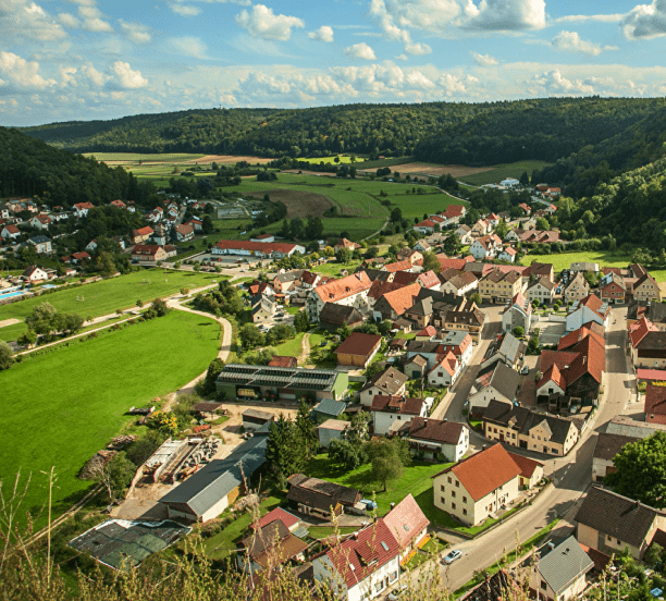
«Ресурс-П предназначен для обновления карт, обеспечения хозяйственной деятельности МПР России, МЧС России, Россельхоза, Росрыболовства, Росгидромета и других потребителей, а также получения информации в области контроля и охраны окружающей среды.


Этапы обработки материалов КА типа "Ресурс-П"
Программный комплекс IMAGE MEDIA CENTER позволяет выполнять первичную обработку данных КА типа "Ресурс-П" №1,2,3,4 аппаратуры "Геотон" и "КШМСА-ВР". Технология обработки полностью автоматизирована и включает следующие этапы:
| Этап обработки | Результат обработки | |
|---|---|---|
| 1. | Уточнение привязки маршрута по опорным точкам (режим: ручной/не обязательный) | Погрешность привязки в градусах |
| 2. | Получение рельефа местности на маршрут для коррекции геометрии съемки (GMTED 2010, 250 м). | Рельеф в формате IMG |
| 3. | RPC-преобразование по отдельным каналам с учетом рельефа и погрешности привязки, определенной на этапе 1. | Трансформированные каналы в формате IMG |
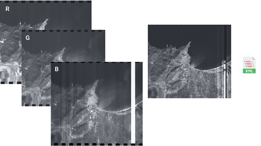
| 4. | Привязка спектральных каналов к панхроматическому для устранения смещения между каналами. Сборка композитного изображения из спектральных каналов. | Файл в формате IMG |
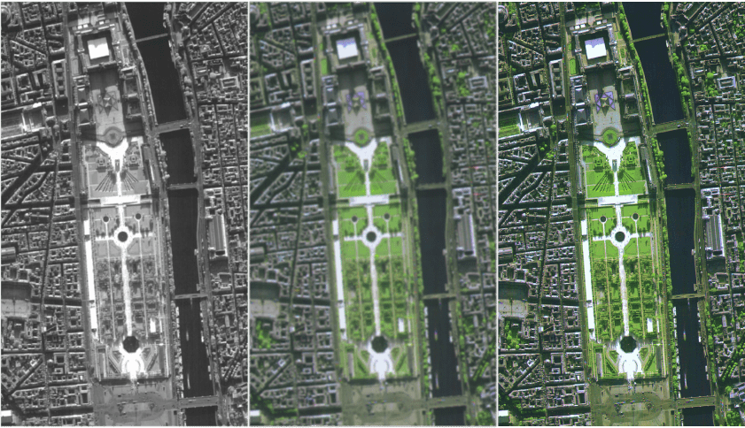
| 5. | Повышение детальности панхроматического изображения. | Повышение детальности на 10-12% |
| 6. | Получение комплексированного изображения в естественных цветах с разрешением панхроматического изображения. | Файл в формате IMG |
| 7. | Устранение шумов на изображении. До обработки отношение сигнал/шум=10 Дб. | После обработки сигнал/шум=13 Дб. |
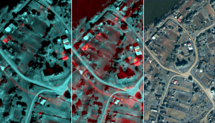
| 8. | Проверка точности привязки и разрешения полученных материалов. | Точность привязки около 10 м (с ОТ) |
Входные данные
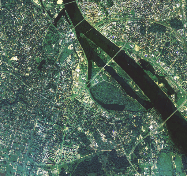
Входными данными являются материалы уровня обработки 1А (изображения по отдельным каналам, без радиометрической коррекции, без ортотрансформирования, не цветосинтезированные, с коэффициентами RPC-полиномов в формате XML).
Радиометрическая коррекция
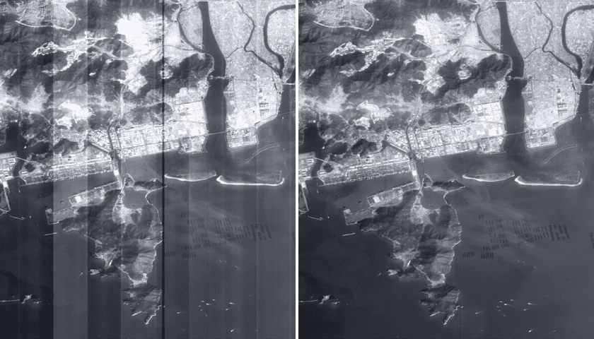
На данном этапе проводится радиометрическая коррекция входных данных, устранение дефектов, обусловленных особенностями съемочной аппаратуры (неравномерной чувствительностью элементов).
Ортотрансформирование
На данном этапе проводится ортотрансформирование снимков с учетом RPC-коэффициентов и цифровой модели рельефа в проекцию, заданную оператором.
Сведение каналов
Привязка спектральных каналов к панхроматическому для устранения смещения между каналами. Сборка композитного изображения из спектральных каналов.
Выходные данные
Выходными данными являются следующие материалы:
- Продукт уровня обработки 2А (панхроматическое изображение с радиометрической и геометрической коррекцией, ортотрансформированное в картографическую проекцию на среднюю высоту по данным бортовой автоматической системы навигации с плановой точностью (СКО) 30-50 м., с коэффициентами RPC-полиномов);
- Продукт уровня обработки 2А1 (цветосинтезированное изображение из 3 каналов (RGB) с радиометрической и геометрической коррекцией, ортотрансформированное в картографическую проекцию на среднюю высоту по данным бортовой автоматической системы навигации с плановой точностью (СКО) 30-50 м., с коэффициентами RPC-полиномов);
- Продукт уровня обработки 4А (комплексированное изображение панхроматического (уровня обработки 2А) и многоспектрального (уровня обработки 2А1) снимков (Pansharpening);
- Паспорт к каждому выходному изображению в формате XML;
- Рамка на маршрут съемки в формате SHP.
При наличии опорных данных и ЦМР выходными данными являются продукты уровней обработки 2В, 2В1, 4В (изображения, ортотрансформированные с использованием опорных данных и ЦМР, плановая точность которых зависит от точности опорной информации).
по первичной обработке данных с КА Ресурс - П