Основные возможности
Базовый функционал программного комплекса


Обработка данных космической съемки
Открытие снимков различных космических аппаратов:
Aist2D, EO-1, FORMOSat 2, Gaofen-2, GeoEye-1, IKONOS 2, Kanopus-B,
Kanopus-1, Kanopus-2, Kanopus-3, Landsat 1, Landsat 2, Landsat 3,
Landsat 4, Landsat 5, Landsat 6, Landsat 7, Landsat 8, Landsat 9,
Meteor-M2, PlanetScope, Pleiades-1A, Pleiades-1B, QuickBird-2, RapidEye,
Resurs-DK1, Resurs-P №1, Resurs-P №2, Resurs-P №3, Sentinel-2, Spot 5,
Spot 6, Spot 7, Triplesat 1, Triplesat 2, Triplesat 3, VNREDSat 1A,
WorldView-1, WorldView-2, WorldView-3.
Cosmo-SkyMED h5, Cosmo-SkyMED XML, TerrraSAR-X/TanDEM-X passport,
Radarsat-2 Passport, Seninel 1A,B, SLC converted data, RCM manifest
Первичная обработка
Сведение каналов
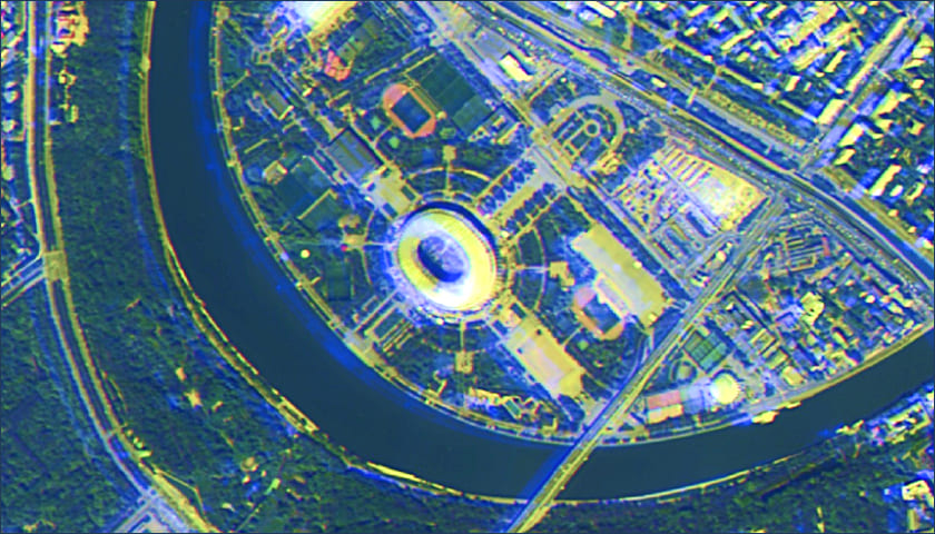
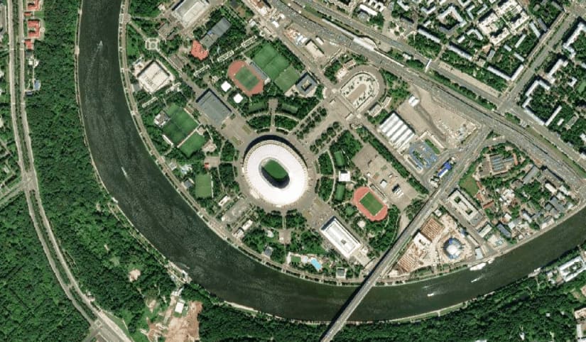
В программном комплексе IMC есть возможность устранить смещение между каналами мультиспектральных данных. Устранение смещения происходит путем привязки спектральных каналов к панхроматическому.
Уточнение геопривязки

Уточнение привязки геоданных происходит с использованием имеющихся пространственных данных, таких как растры с пространственной привязкой или векторные объекты, которые имеют нужную систему координат. Это позволяет связать два снимка так, чтобы одни и те же объекты на этих снимках были расположены по одним координатам при помощи опорных точек.
В программном комплексе реализована функция автоматического поиска связующих точек, а так же инструментарий для самостоятельного набора опорных точек самим оператором.
Предварительная обработка
Предварительная обработка
Предварительная обработка в ПК IMC включает в себя:
- чтение паспорта снимка;
- формирование композитного изображения;
- назначение цветовых каналов;
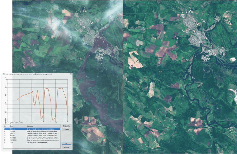
- атмосферную коррекцию изображения;
- удаление неинформативных полей.
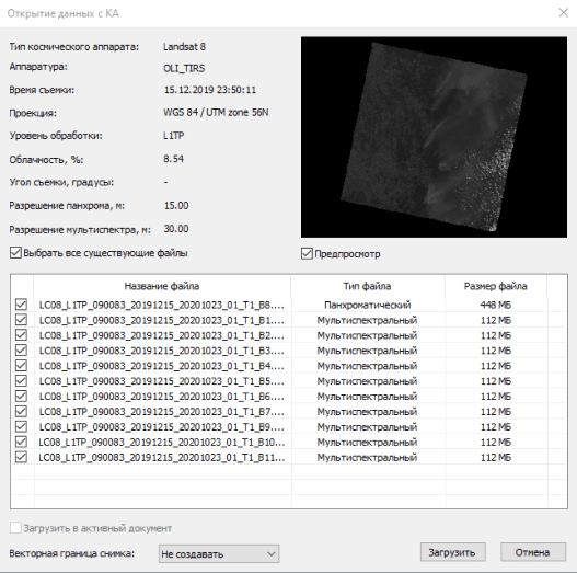
Чтение паспорта снимка
Паспорт снимка содержится в наборе исходных данных в текстовом формате или формате XML. В ПК IMC данные из паспорта считываются автоматически с последующим формированием композитного изображения.
Также автоматически заполняется информация о каналах изображения: диапазоны длин волн, ширина диапазонов, коэффициент усиления, сдвиг. И метаданные: наименование КА, время/дата съемки, тип сенсора, тип слоя, разрешение, облачность
Атмосферная корекция
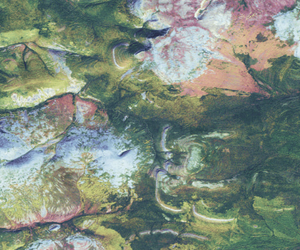
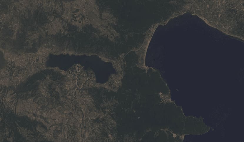
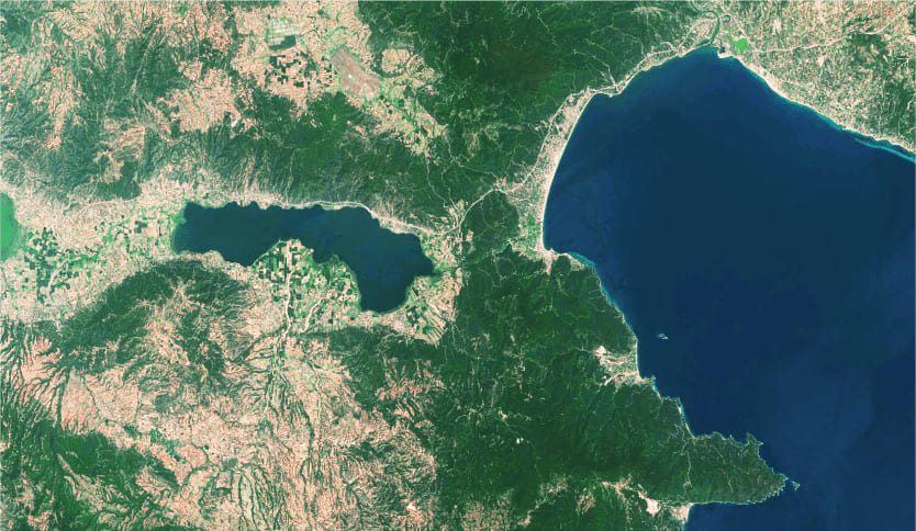
Целью атмосферной коррекции является получение отражательной способности поверхности (которая характеризует свойства поверхности) от удаленных зондов путем удаления атмосферных эффектов.
В ПК IMC есть два способа проведения атмосферной коррекции: общая коррекция и модель атмосферы.
Общая атмосферная коррекция настраивается вручную оператором при наличии необходимых параметров.
Во втором способе проводится атмосферная коррекция по графику пропускания атмосферы, который можно выбрать из предложенного списка или загрузить необходимый.
Паншарпенинг
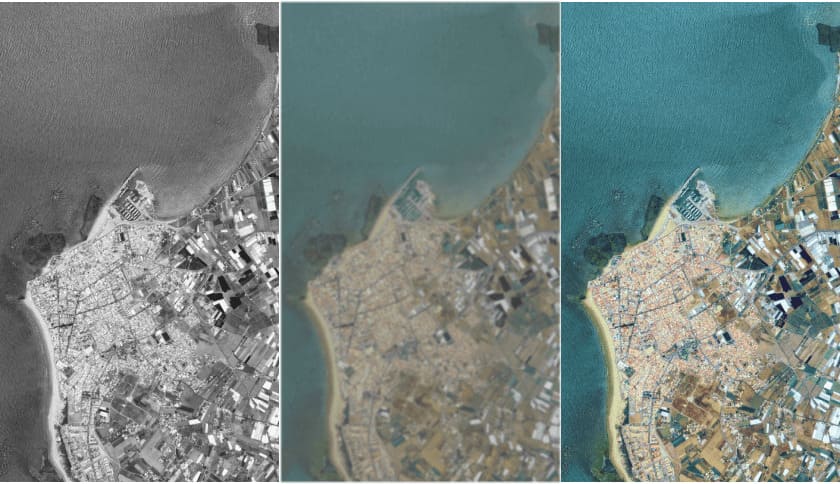
Паншарпенинг позволяет получить из панхроматического и мультиспектрального каналов двух продуктов одно изображение. Панхроматический канал, как правило, имеет более высокое пространственное разрешение, мультиспектральный – более низкое. В результате слияния каналов получается цветное изображение с высоким разрешением.
Устранение шума
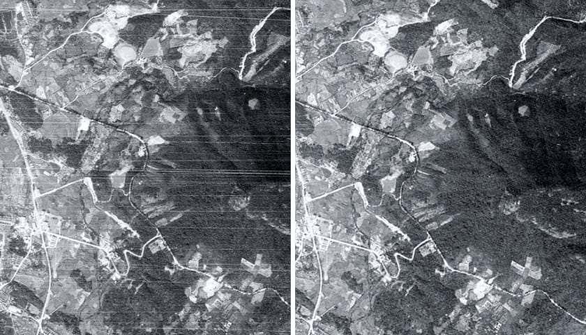
В ПК IMC реализованы методы фильтрации, использующиеся для устранения шума и единичных дефектов, представляющего собой резкие локальные скачки яркости, в том случае, если основными объектами для анализа являются площадные объекты.
Повышение линейного разрешения
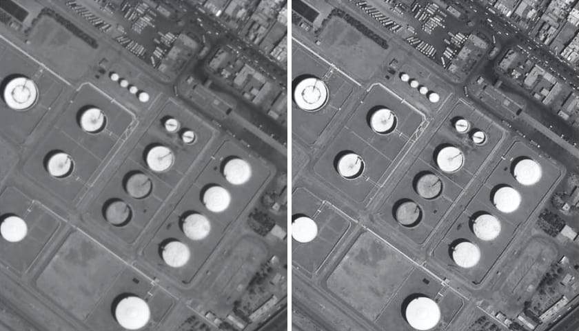
В программном комплексе IMC есть возможность повышения линейного разрешения снимков и оценка качества исходных материалов.

Тематическая обработка
Методы тематической обработки спутниковых снимков позволяют детально изучать изображения и получать векторные слои с атрибутивной информацией, в том числе и в автоматическом режиме. В программном комплексе IMAGE MEDIA CENTER реализован широкий спектр инструментов для тематической обработки спутниковых снимков.
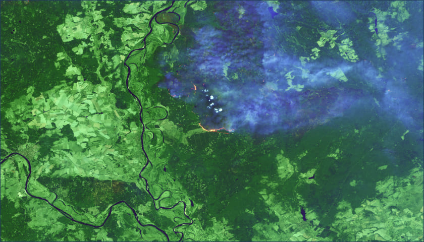
Анализ изображений в псевдоцветах
Анализ изображений в псевдоцветах включает:
- применение различных комбинаций цветовых каналов;
- метод наибольшего подобия;
- использование цветовых пространств (RGB, CMYK, Lab, HLS, HSB).
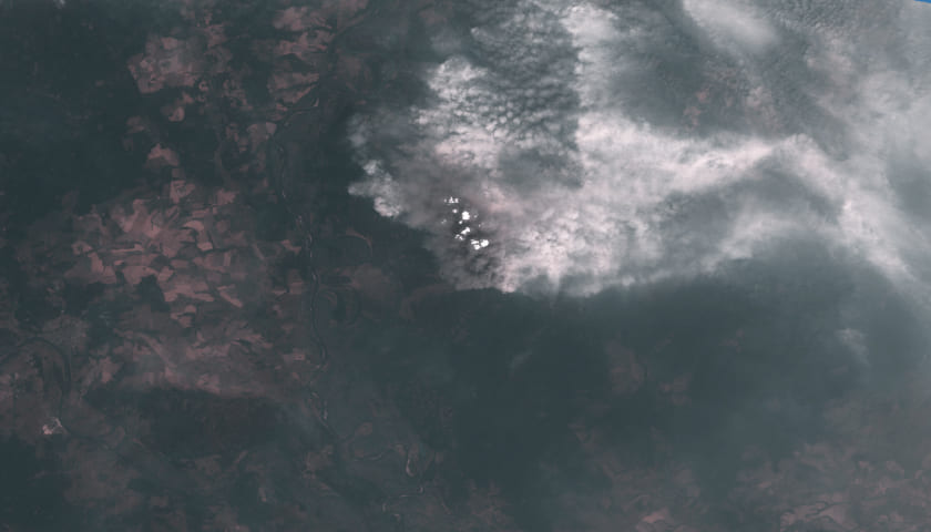
Анализ изображений в псевдоцветах полезен при выявлении конкретных объектов, как например, выявление пожаров на снимках.
Формирование и анализ индексных изображений
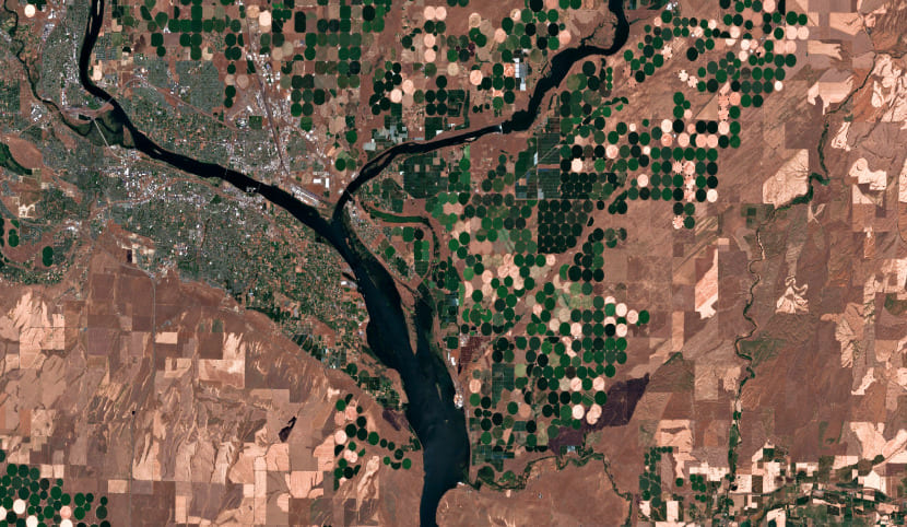
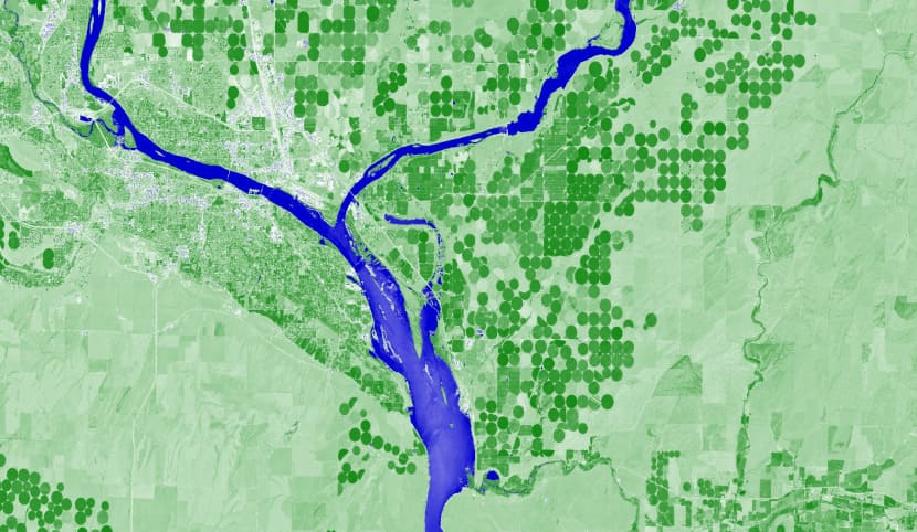
Значение яркости каждого пиксела индексного изображения формируется путем проведения математических операций, в которых в качестве параметров используются значения яркости каждого пиксела из разных каналов снимка.
В зависимости от цели исследования используются различные индексы:
- вегетационные индексы;
- почвенные индексы;
- водные индексы;
- снежные индексы;
- пользовательские индексы.
Для формирования индексных изображений в ПК IMC реализован инструмент "Калькулятор каналов", который позволяет пользователю составлять любые математические формулы с использованием каналов изображения.
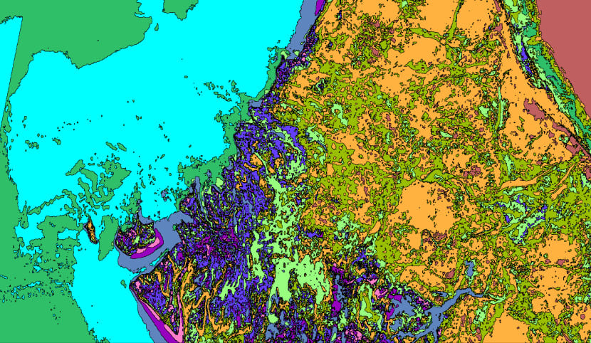
Кластеризация
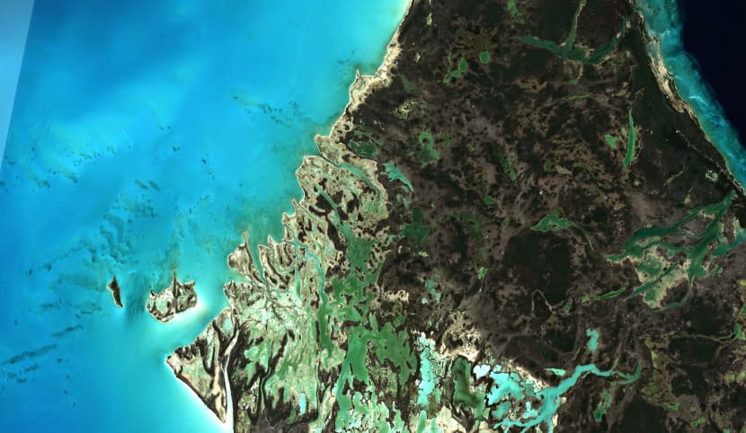
Если неизвестно какие объекты присутствуют на исходном изображении, в ПК IMC есть возможность проведения классификации без обучения двумя способами: с учетом k - средних и нечеткой кластеризации.
Метод кластеризации с учетом k - средних - наиболее популярный, его суть состоит в: распределении объектов выборки по кластерам, пересчете центров кластеров.
Метод нечеткой кластеризации при котором каждая точка данных может принадлежать более чем одному кластеру.
После проведения кластеризации необходимо дешифрирование полученных классов, чтобы определить, каким объектам они соответствуют.
Таким образом, классификацию без обучения применяют:
- если заранее неизвестно какие объекты есть на снимке;
- на снимке большое количество объектов (более 30) со сложными границами;
- также можно применять, как предварительный этап перед классификацией с обучением.
Классификация с обучением
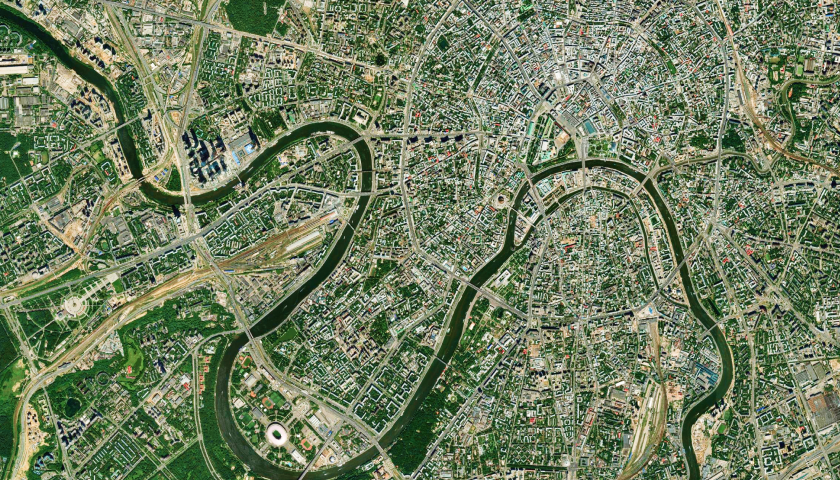
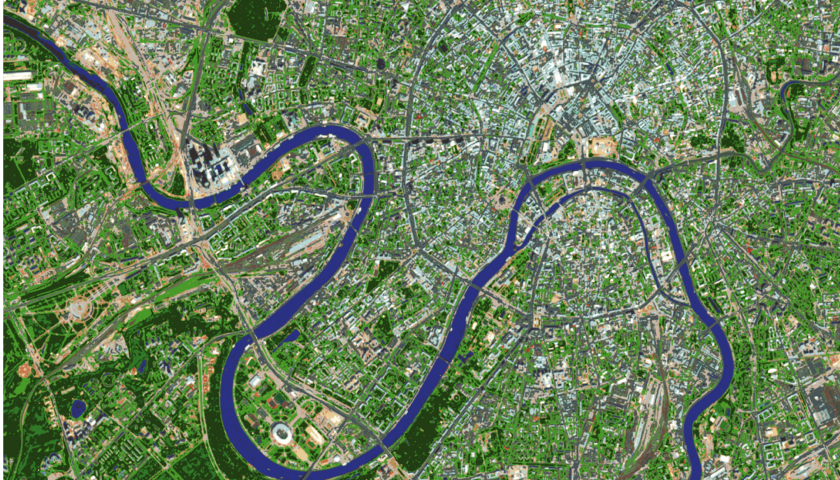
Для контролируемой классификации используются эталонные области, которые определяет оператор исходя из их принадлежности определенному классу объектов. Для последующего распознавания в качестве обучающих выборок используются значения пикселей эталонных областей в различных спектральных диапазонах.
Таким образом, каждый пиксель изображения относится к определенному классу на основании последовательного сравнения со всеми созданными эталонами. При контролируемой классификации сначала определяются информационные классы, а затем, на их основе, спектральные.
После набора классов в ПК IMC есть возможность выбрать способ классификации:
- метод наименьшего расстояния;
- метод наибольшего подобия;
- классификация по расстоянию Махаланобиса.
Спектральный анализ
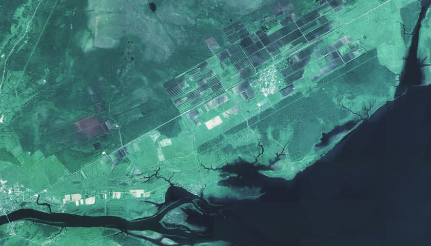
Основными величинами, подлежащими изменению при спектральном анализе, являются длина волны, интенсивность отраженного сигнала и пространственная координата исследуемой поверхности.
В ПК IMC реализованы следующие методы спектрального анализа:
- корреляция с/без учета амплитуды;
- двоичное кодирование;
- спектрально-угловое картирование;
- ортогональная проекция подпространства.
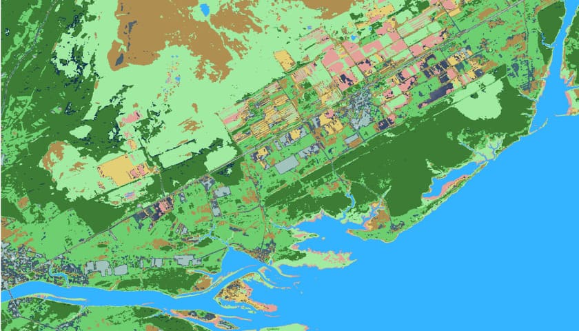
Текстурный анализ
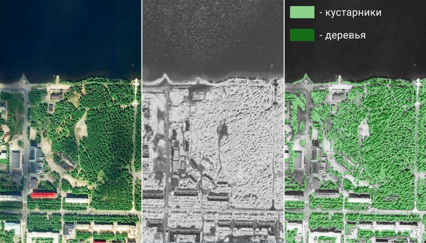
В программном комплексе IMC есть возможность решения ряда тематических задач с помощью текстурного анализа - совокупности методов качественного и количественного определения характеристик объектов, процессов и явлений на земной поверхности и в атмосфере, основанная на исследовании их структурных особенностей на данных ДЗЗ.
Под текстурой понимается набор признаков изображения, характеризующих его степень однородности, изотропности, регулярности.
Работа с векторными данными
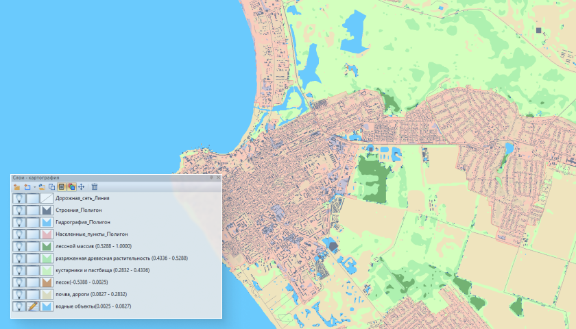
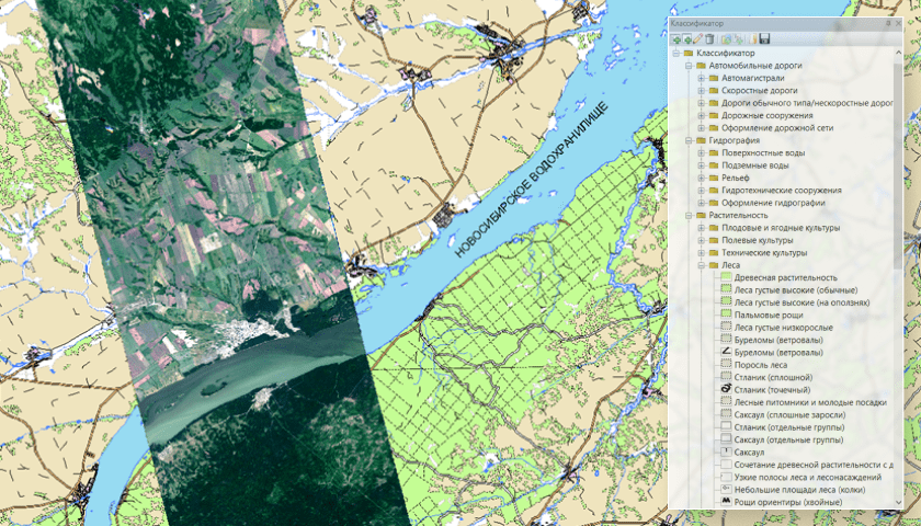
Работа с векторными данными в рамках ПК IMC включает в себя создание и назначение стилей отображения векторных объектов, а также формирование классификаторов с учетом типов объектов, масштаба отображения и набора атрибутивных данных.
Функционал ПК IMC позволяет создавать векторные объекты любой сложности (маркеры, линии, полигоны, составные объекты).
Векторные слои могут быть сохранены в международных форматах SHP и TAB, а также во внутреннем формате IMF, который позволяет хранить растровые и векторные слои с атрибутивной информацией в едином документе.
Условные знаки
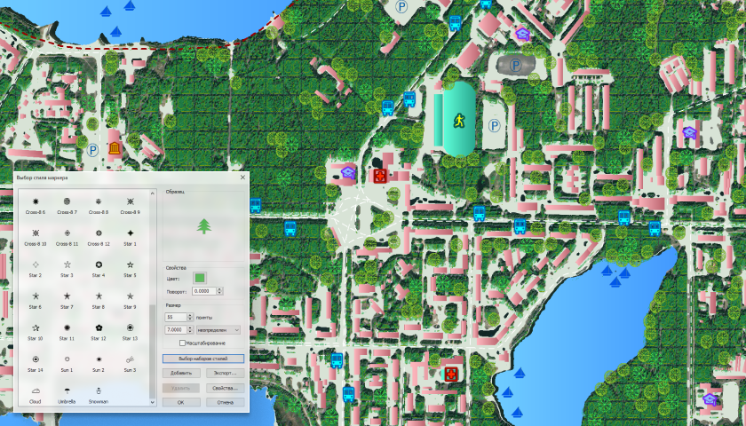
В IMC возможно создание и редактирование любых стилей условных знаков.
Программный комплекс позволяет редактировать условные знаки по многим параметрам, таких как:
- цвет;
- угол поворота;
- размер;
- дополнительные параметры в виде свечения, тени, обводки и д.р.
Буферные зоны
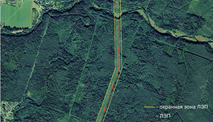
В программном комплексе IMC есть возможность добавления буферных зон по нормативам в зависимости от задачи пользователя.
Можно создавать векторные буферные зоны для охранной зоны линий электропередач, железнодорожных путей, автостоянок, газопроводов и т.д., в зависимости от решаемой конкретной задачи, а так же есть инструментарий для создания пользовательской буферной зоны со значениями, задаваемыми оператором и возможность построения буферных зон пересекающихся объектов.
Проверка топологии
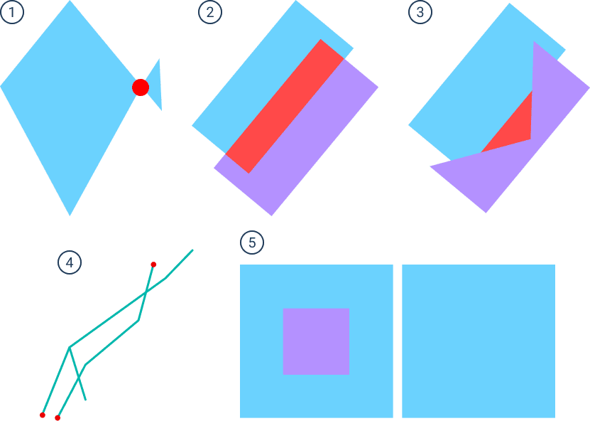
Проверка топологии может выполняться как для всех объектов редактируемого векторного слоя, так и для текущей выборки векторных объектов. По результатам проверки создается новый векторный слой с детектированными ошибками.
Проверка топологии может включать в себя:
1) Поиск самопересечений полигонов: в результате проверки создается векторный слой с точками в местах самопересечений полигонов.
2) Поиск перекрытий полигонов: в результате проверки создается векторный слой с полигональными объектами, детектирующими перекрытия полигонов.
3) Поиск пустот между полигонами: в результате проверки создается векторный слой с полигональными объектами, детектирующими пустоты между полигонами.
4) Поиск висячих узлов: в результате проверки создается векторный слой с точечными объектами, детектирующими узлы, расположенные на расстоянии, меньше заданного пользователем относительно других линейных объектов слоя.
5) Секция «Фильтрация объектов по площади» позволяет отфильтровать объекты, площадь которых меньше заданной.
Ранжирование плотности векторных объектов
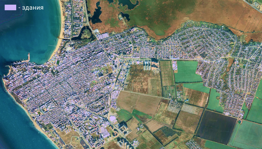
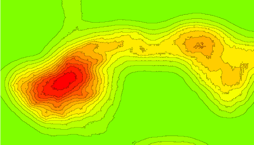
Объекты полигональной темы изображаются точками, число которых, умноженное на вес точки, соответствует значению выбранного для отображения на карте атрибута. Используется для демонстрации распределения какого-либо явления по площади.
Инструмент предназначен для составления карт плотности точечных объектов векторного слоя. По окончании работы алгоритма создается растровый слой со значениями плотности.
Работа с таблицей атрибутов

В ПК IMC есть возможность создания и редактирования атрибутивных таблиц для векторных объектов. Таблица может служить для подсчета результатов данных проведенной обработки. Можно создавать символьные, числовые, логические и другие поля, а также составлять математические выражения, например, для подсчета площади векторных объектов.
В ПК IMC есть возможность редактировать и выполнять поиск по атрибутам с помощью SQL - запросов.
Атрибутивную информация возможно сохранить в формате .csv.
Совмещение космических снимков
с сервисами WMS, WFS
В IMC есть возможность добавления в документ веб-слоя на базе данных WMS и WFS.
WMS сервис позволяет загружать векторные данные, которые содержат информацию о границах государств и административном делении, данных рельефа, об объектах природы, топографические данные, данные об энергетических ресурсах и д.р.
WFS сервис позволяет загружать векторные данные, которые содержат обобщенную информацию о демографии различных стран и всего Мира, границах государств и административном делении, данные рельефа, топографические данные, данные об энергетических ресурсах.
Каталогизация данных
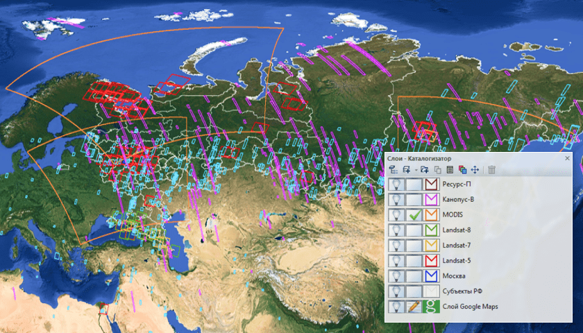
В IMC возможно формирование и хранение базы данных, содержащих маршруты съемки и отдельные снимки, а так же функции поиска информации в электронном каталоге, обеспечивающие выборку информации по искомым значениям.
Параметры поиска:
- маршрут;
- тип КА;
- аппаратура;
- дата съемки;
- территория;
- описание;
Автоматизация процессов
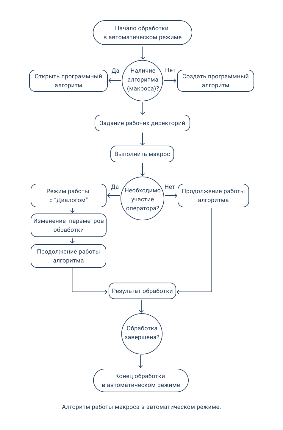
Программный алгоритм (макрос), заранее записанная последовательность пользовательских действий, которые можно применять к разным наборам исходных данных. Механизм макросов используется для автоматизированного решения однотипных задач по заданным алгоритмам обработки в IMC.
Записанный макрос позволяет в автоматическом режиме проводить тематическую обработку, от предварительной обработки материалов космической съемки до графические и текстовые отчеты на основе результатов обработки.
После записи макросы сохраняются в формате MCR. Действия в алгоритме могут быть в любой момент добавлены, удалены, перезаписаны.
- возможность сохранения алгоритма в формате MCR;
- возможность последующего редактирования макроса;
- работа с относительными путями;
- запуск макроса в серверном режиме.
Пример работы алгоритма
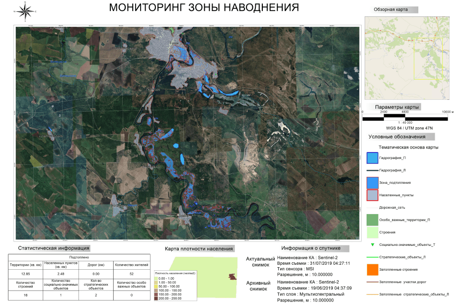
Мониторинг паводков и наводнений
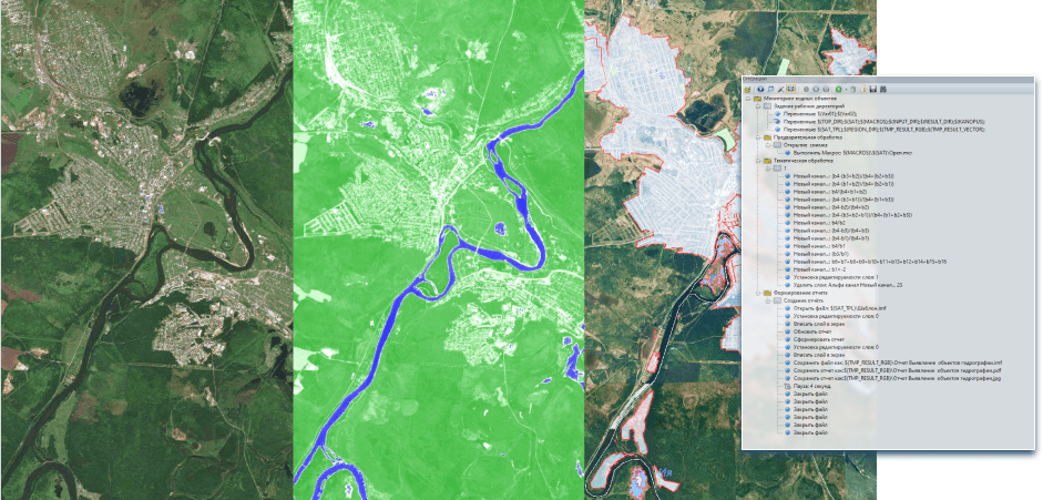
Чтобы провести мониторинг паводкоопасных участков или смоделировать зону наводнений, можно выполнить готовый алгоритм или создать свой, для последующего решения типовых задач.
Первым этапом выполнения алгоритма является задание рабочих директорий - запись относительных путей с помощью которых будет взаимодействовать макрос (открытие и сохранение файлов).
Следующий этап - предварительная обработка снимка: открытие паспорта, коррекция изображения, удаление неинформативных полей и создание границы снимка.
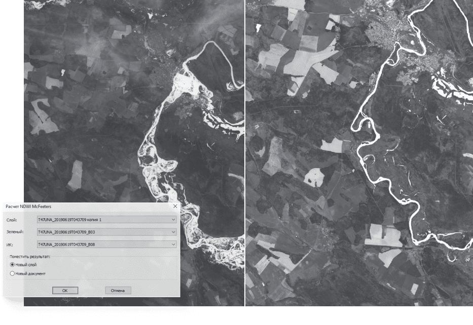
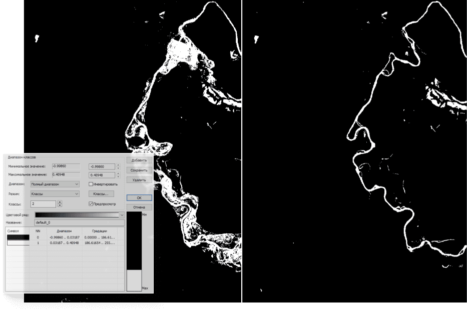
После предварительной обработки проводится тематическая. Для моделирования наводнений создается изображение, рассчитываемое с помощью индекса NDWI по архивному и актуальному снимку. К индексному изображению применяется цветовой ряд. С помощью выбранного диапазона значений отделяются водные объекты от других.
Для векторного слоя воды создается атрибутивная таблица со значениями площадей.
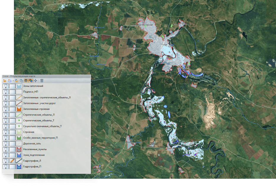
Для того, чтобы выделить участки, которые могут оказаться в опасной зоне, подгружаются дополнительные векторные объекты с данными о строениях, дорожной сети, социально-значимые объекты и другие.
После проведения тематической обработки создается результирующая карта с исходным снимком и полученными векторными объектами.
По данным результирующей карты формируется отчет с основной информацией, полученной в результате тематической обработки: граница снимка на общей карте, результирующая карта, таблица с атрибутами.
Посмотреть схему алгоритма тематической задачи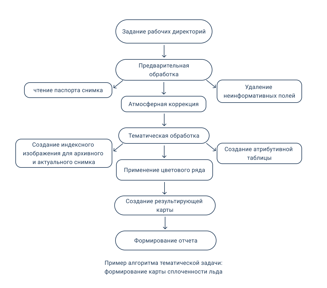
Формирование отчетов
Для комплексной оценки результатов тематической обработки в ПК IMC реализована возможность формирования отчетов, которые могут содержать: снимки, тематические карты, легенду, графики, диаграммы и т.д.
Отчетные формы предназначены для дальнейшей печати и представлены в основных размерах бумаги (А4, А3, А2, 640 х 480 и т.д.), либо предусматривается возможность произвольного размера, заданного оператором.
Также возможно формирование отчета в портретной и альбомной ориентации.
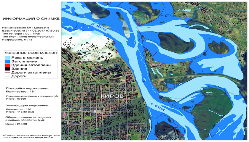
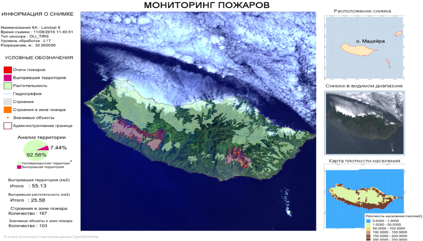
Отчеты в программном комплексе Image Media Center могут быть как графические, так и текстовые, и могут быть сохранены в форматах JPG, PDF, CSV.
Функционал ПК IMC позволяет создавать шаблоны отчетов, которые удобно использовать для демонстрации результатов выполнения конкретной задачи с различными входными данными, например, в ходе разновременного мониторинга.


