Первичная обработка
материалов с КА «Канопус-В»
Особенности первичной обработки
снимков со спутника «Канопус-В» в ПК IMC


Канопус-В
«Канопус-В» № 1 - российский космический аппарат оперативного мониторинга техногенных и природных чрезвычайных ситуаций. Запущен 22 июля 2012 года с космодрома Байконур. Данные, получаемые с «Канопус-В», содержат RPC-полиномы инструмент для повышения точности изображения и ускорения процесса обработки данных.
«БКА» (Белорусский космический аппарат) запущен вместе с российским спутником «Канопус-В», обладает идентичными техническими характеристиками.


Этапы обработки материалов КА типа "Канопус-В"
Технология обработки материалов с КА типа "Канопус-В" и "БКА" в программном комплексе IMAGE MEDIA CENTER полностью автоматизирована и включает в себя следующие этапы:
| Этап обработки | Результат обработки | |
|---|---|---|
| 1. | Уточнение привязки маршрута по опорным точкам (режим: ручной/не обязательный) | Погрешность привязки в градусах |
| 2. | Получение рельефа местности на маршрут для коррекции геометрии съемки (GMTED 2010, 250 м). | Рельеф в формате IMG |
| 3. | RPC-преобразование микрокадров с учетом рельефа и погрешности привязки, определенной на этапе 1. | Трансформированные каналы в формате IMG |
| 4. | Сшивка микрокадров по отдельным каналам на маршрут съемки. | 5 каналов (ПАН + 4 МС) в формате IMG |
| 5. | Привязка четырех спектральных каналов к панхроматическому для устранения смещения между каналами. Сборка композитного изображения из спектральных каналов. | Файл в формате IMG с 4-мя каналами |
| 6. | Повышение детальности панхроматического изображения. | Повышение детальности на 10-12% |
| 7. | Получение комплексированного изображения в естественных цветах с разрешением панхроматического изображения. | После обработки сигнал/шум=13 Дб. |
| 8. | Устранение шумов на изображении. До обработки отношение сигнал/шум=10 Дб. | Точность привязки около 10 м (с ОТ) |
| 9. | Проверка точности привязки и разрешения полученных материалов. | Точность привязки около 10 м (с ОТ) |
Входные данные
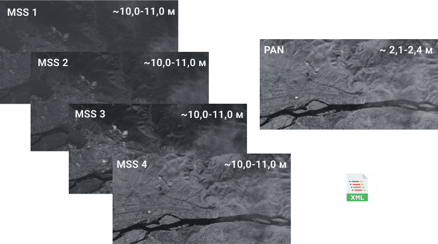
Входными данными являются материалы уровня обработки 1 - один или группа микрокадров, полученных в разных спектральных каналах, принадлежащих одному маршруту съемки, без радиометрической коррекции, без ортотрансформирования, не цветосинтезированные, с коэффициентами RPC-полиномов.
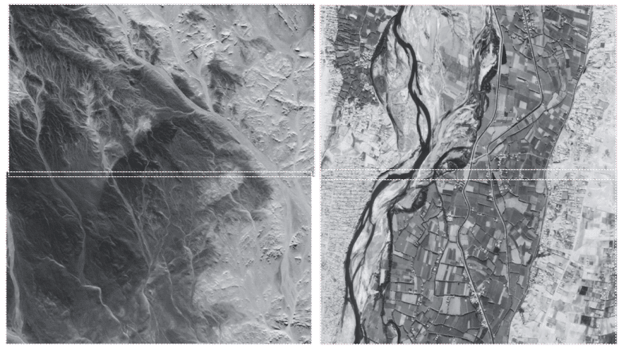
Ортотрансформирование отдельных микрокадров
На данном этапе производится ортотрансформирование отдельных микрокадров с учетом RPC-коэффициентов и цифровой модели рельефа в проекцию UTM на референцэллипсоиде WGS-84. Перед запуском автоматической обработки может проводиться уточнение привязки маршрута путем вычисления погрешности привязки по нескольким МК-рам. Для обработки используется рельеф GMTED 2010 (250 м) в формате IMG. Дополнительно могут быть заданы координаты опорных точек для уточнения привязки.
Сшивка микрокадров по отдельным каналам
и радиометрическая коррекция
На данном этапе с помощью корреляционных методов осуществляется сшивка микрокадров по отдельным каналам и производится коррекция яркости микрокадров с помощью инновационного алгоритма радиометрической коррекции. В результате выполнения данного этапа формируется пять файлов (панхроматический и четыре спектральных канала) в формате IMG.
Сведение каналов
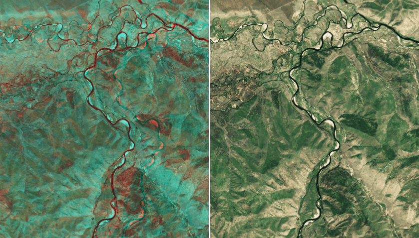
На данном этапе производится устранение смещения между каналами путем привязки четырех спектральных каналов к панхроматическому. В результате выполнения данного этапа формируется пять файлов (панхроматический и четыре скорректированных спектральных канала) в формате IMG.
Выходные данные
Выходными данными являются следующие материалы:
- Продукт уровня обработки 2А (панхроматическое изображение, полученное в результате сшивки микрокадров, трансформированное в картографическую проекцию по данным бортовой автоматической системы навигации на среднюю высоту с плановой точностью (СКО) не хуже 50 метров);
- Продукт уровня обработки 2А1 (Цветосинтезированный снимок из 4 спектральных каналов (RGB+ИК), трансформированный в картографическую проекцию по данным бортовой автоматической системы навигации на среднюю высоту с плановой точностью (СКО)не хуже 50 метров);
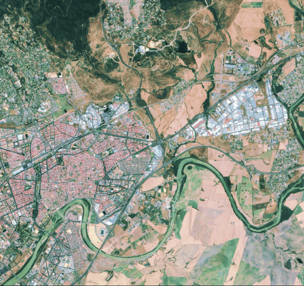
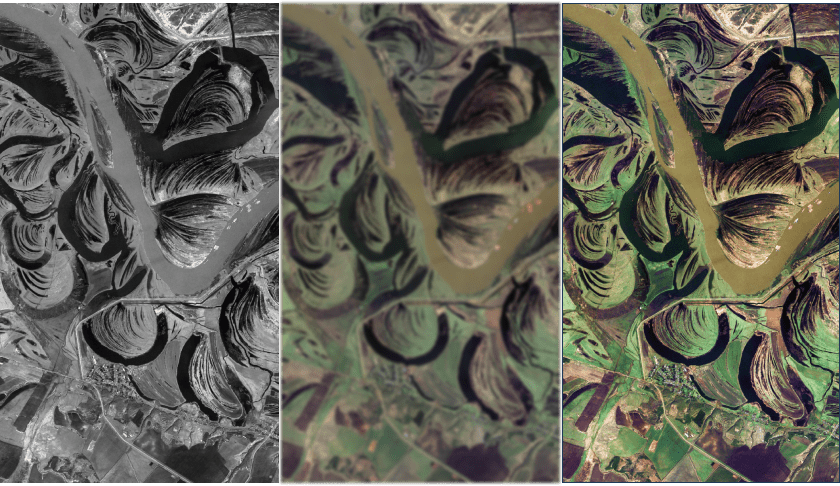
- Продукт уровня обработки 4А (Комплексированное изображение из панхроматического (уровня обработки 2А) и многоспектрального (уровня обработки 2А1) снимков одной и той же территории (Pansharpening), с плановой точностью (СКО) не хуже 50 метров);
- Паспорт к каждому выходному изображению в формате XML;
- Рамка на маршрут съемки в формате SHP.
При наличие опорных данных и ЦМР выходными данными являются продукты уровней обработки 2В, 2В1, 4В (изображения, ортотрансформированные с использованием опорных данных и ЦМР, плановая точность которых зависит от точности опорной информации).
по первичной обработке данных с КА “Канопус-В”