Решаемые задачи недели
Еженедельный обзор актуальных
задач в программном комплексе IMC


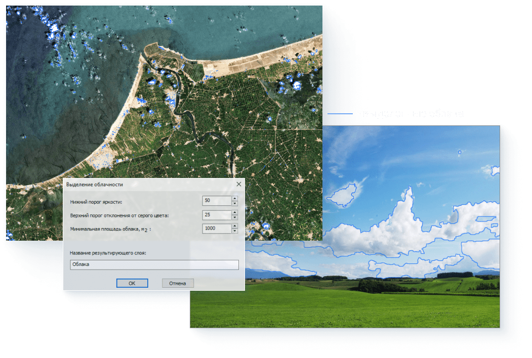
Устранение облаков
на космических снимках
Спутниковые снимки создают большую перспективу для непрерывного мониторинга окружающей среды и наблюдения Земли.
В настоящее время съемка со спутников в большинстве случаев производится в ясную безоблачную погоду, что позволяет получить качественные снимки заданной местности и снизить объем работы на этапе предобработки, но так случается не всегда.
Затенения, создаваемые облаками, могут серьезно ограничить охват, затрудняя извлечение наземной информации.
В программном комплексе IMC существует автоматизированный инструмент для устранения облаков и теней на космических снимках.
Посмотреть решение задачипо удалению облачности

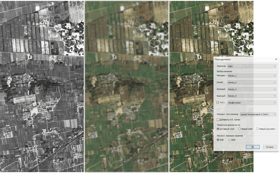
Паншарпенинг
Пространственное разрешение космического снимка имеет прямое влияние на его интерпретацию. Чем выше разрешение, тем более детальную информацию мы можем получить о картографируемой зоне.
В программном комплексе IMC существует специализированный инструмент для создания паншарпенинга, который позволяет сформировать комплексированное изображения в естественных цветах с разрешением панхроматического изображения.
Есть возможность сформировать паншарпенинг разными методами.
Посмотреть какосуществляется паншарпенинг

Разновременной анализ
Данные космического мониторинга широко применяются для исследования земной поверхности.
Одно из предназначений космического мониторинга – это решение задачи поиска изменений состояния земной поверхности по разновременным данным дистанционного зондирования Земли.
В программном комплексе Image Media Center есть возможность проведения разновременного анализа несколькими методами для снимков разных детальностей: вычитание разновременных снимков, получение многовременных индексов, попиксельный анализ и цветовой синтез разновременных снимков.
Посмотреть примерразновременного анализа
